navigation

Cyber Monday Motorcycle Deal

rever_screenshot_premium.png

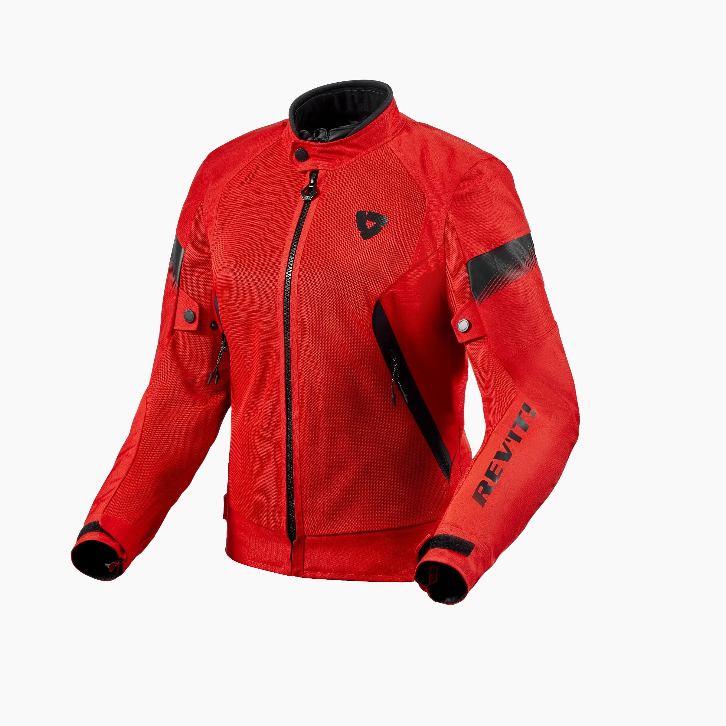
Cyber Monday is almost over. I just bought this 50% off deal from Rever. If you’re looking for turn by turn directions, and a reason to get rid of your Garmin, try this app. You have to purchase the premium version to get the best features, but based on what I’ve read and other user’s feedback, it’s worth trying for $30 for a year rather than $400-$600 for a gps device.

https://a.rever.co/

Cyber Monday Code: BlackFriday2018

As much as I love using my other app (iPhone only) inRoute , I’m excited to try something different, since it was made specifically for motorcyclists!

InRoute, a way to navigate with your iPhone and Sena!

Finally, what I've been waiting for. A reason to replace my Garmin Zumo. Which may not happen immediately, but I foresee this as a really, really great tool.

I know, I just published my Garmin Zumo 390 review but now I found what I have been searching for! An iPhone app that lets me import the GPX file I need from Furkot and then it reads the turn by turn directions into my Sena SMH10R.

This iPhone app is called InRoute Route Planner. It's a free app but it comes with optional upgrades, which I'll gladly pay for. The free version allows for up to 24 locations in a particular map I think. It's $2.99/month or $24.99 for the year if you want up to 100 locations per map. So I went ahead and bought a year. Why not? 

If I can successfully use this app for all my turn by turn navigation, then adios Garmin! Fingers crossed, as we leave for Port Jervis in the morning on a quick overnight :)

Update August 2016

I've now been using the InRoute app exclusively for the past two months. It has definitely done its job and very well, I might add. 

There are two things that I've wanted my phone to do for me; navigate and then give me turn by turn directions through my Sena SMH10R Headset so I don't have to look down or check to see what the display is showing.  Although it has some minor issues to resolve, overall its the best navigation option I've ever used. 

Back in June my husband and I ventured north to Port Jervis, NY. We left early Sunday morning and then headed up to the border as far as we felt like going. Then we grabbed a hotel for the night once we got into New York. 

Opening GPX Files

The photo above is the ambitious ride route I laid out for us. You can download a copy of the GPX file here. :)  All you have to do is either create a route on a website such as Furkot.com, save it as a .GPX and then open it easily on your iPhone (there are others I'm sure, just use whatever site or software application you want to create the GPX). (Or, alternatively you can create a route on the fly right inside the app. We'll get to that part in a bit, so keep scrolling if you want that part.) 

I use iCloud Drive (in addition to Google Drive) so all I have to do is open my file. Once you create the GPX on your desktop, you could also just email it to yourself too. Once I've found my file, I just tell my phone how I want to view it. 

inroute_openingfiles

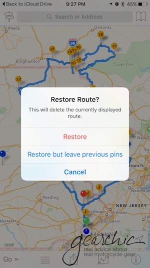
In this instance, I want it to "copy to InRoute". If I already have another route or map open, it'll ask me if I want to Restore Route. I Choose Restore. 

inroute_restore

And then voila! I have my ride route. All I have to do is hit GO and we're off. My Sena starts talking to me and I'm ready to ride. 

Creating Routes on the Fly

However, sometimes you just need to make a quick route without a computer nearby. This is my favorite feature. I can instantly create a route, tweak it and then share it with my husband so he can also lead part way. It's as simple as putting your finger exactly where your destination is. As soon as you do, it asks you if that's going to be your Start, a Waypoint or your Destination. For this example, I choose Destination. 

inroute_shamokin

But I really really really don't want to take the turnpike there. And this map much like other maps might assume you do. No Thank You. Maybe I want to visit the infamous stretch of road where I lowsided last year to see if they patched up the entire roadway or not. So I place my finger at on the road and it drops a pin. I select Waypoint.  

Now, we have a decent route!

Inroute_143

But let's just say that I want to make another stop along the way, just for fun. 

Crap. Now things are in the wrong order. No problem :) Click on the little 2Way Sign in the upper left corner. 

Now you have this handy option to Optimize Waypoint Order. SO handy. You can also rearrange points manually here too. If you select a particular point you can then delete it. 

Now that I've rearranged the order, I have a proper route. 

Then when it comes to sharing this route with the man, I just text it to him like any other image or file on my iPhone. 

The only downsides of the app that we've discovered are:

  1. It uses the Apple Maps Engine. For some reason, and I'm not quite sure why, it won't interrupt my intercom conversation with my husband to give me the directions. I have to toggle back to my phone to hear it. I'm ok with this for now, because it's a small sacrifice to have a much better app interface such as this. Google Maps and Waze don't do this, so it's definitely possible and most likely a feature they have to program into the app (something about APIs to tell the phone that it's an incoming phone call, not just music - per my mobile app developer expert husband). 
  2. The Northeast is full of roads and highways with multiple names. Look at this one for instance. You can see that Route 143 is also known as "Ontelaunee Trail". It might tell me one or the other, so I have to trust it when it tells me to turn somewhere. It doesn't always do this, but often enough that I try not to worry as much if I'm turning at the right point. 

A couple of fun features is that it offers temperature, humidity and a few other details along your route, super handy. 

Those are the main features that I use on the app. I'm sure I'll discover more as I use it further. 

Other than those two details, I don't foresee going back to the Zumo anytime soon. The only thing I still might need is a waterproof case which is easy to come by.

In order to have my phone easily accessible on the bike I purchased this Ram Universal X-Grip cellphone holder. All I had to do was take off the Garmin Mount from the Ram Arm and swap it for the X-Grip. 


Garmin Zumo 660LM on my Triumph Street Triple

ram_mount_garmin_zumo_660_triumph_street_triple After a couple hours of wrangling with various Ram Mounts, I finally mounted my new Garmin Zumo 660LM on my 2012 Triumph Street Triple R. 

First, I bought the Zumo on sale from Amazon. 50% off, no tax and free shipping (with my Prime membership). Then I ordered the Ram Mounts Fork Stem Kit.

Everything else you need to mount and power the Zumo comes in the box. I decided to use the Power Cable that comes in the box and mount it on the Fork Stem Kit. Although I could use a USB cable instead, I went with the Power Cable. I didn't think that I could power the Zumo via USB but by the time I realized my mistake I already ran the Power Cable along my bike under the tank to the battery.

Unfortunately the cable doesn't come ready for you to install directly to your battery. My husband had to solder connectors to the positive and negative, so for now it's directly wired to my battery. I don't think this will be permanent, as I'd rather have it connected to my ignition wiring but I need to figure out the proper way to do that first. For now, I will have to be extra careful so as to not leave the Zumo on the bike if it's not running.

garmin_zumo_660_triumph_street_triple


I like how it turned out and the Fork Stem Mount is a much better alternative to mounting it to the handlebar. Now I'm ready to navigate!

I know what you're thinking, why not just use your iPhone to do the navigating? I've tried. Believe me, I've tried. The one hurdle with using your iPhone as a navigator is how Difficult it is to create a route, input it into an app on the phone and THEN have it give you Turn by Turn directions! It seems to easy, but this last part is the MOST difficult aspect of the process.

I found an incredible tool not long ago called Furkot.com, to help me plan out my itinerary including gas stops and meals based on mileage range and travel times. It's awesome. I also figured out how to export that map into my iPhone using an app called Osmand and it even shows me my route. I did find some complicated methods of exporting files, downloading apps (PCs ONLY, I'm a mac girl) and converting things to use on my iPhone but I'm never going to buy a PC just to do that. So for me, spending $379 on a Garmin is well worth it. Inputting maps is easy with the Basecamp Software (although I prefer to keep navigating in Furkot).

My husband and I will be heading north up to Hancock, NY to spend next weekend riding. Can't wait to input some routes and ride the twisties!

First Ride 2015 on My Triumph and Navigating with Garmin

triumph street triple R motorcycles riding pennsylvania Ahhh that was a great ride. This was my first official ride with the Philly Moto Girls (only women can be members, but significant others are always invited to join rides).  And my first long ride on the Street Triple !!

I mapped out this ridiculously insane route, but sadly, my written maps have failed me yet again. I seem to get lost on every adventure because these are all new roads for me!

I've been trying to figure out a way to navigate on my iPhone and have found a few apps that do this. Unfortunately I have found them to be clunky, with the interfaces being rather difficult as to allowing me to import my google maps. But even if they did let me do that, I would have to pull over, take my phone out and pull off my gloves. And if you know me, I don't sacrifice protection for convenience. I'm not going to give up my incredibly protective riding gloves for something that has touchscreen-ability. I love my gloves!

So I bit the bullet and on a friend's suggestion (Thanks Anthony and Kate!!) I purchased a used Garmin Nuvi 765T, the car edition. It was $80 on eBay, and I have the option to return the sucker if it lets me down. I NEED the ability to import routes, and although I could maybe do it on Navigon, that doesn't eliminate my need to remove my gloves to use the iPhone even if it's mounted on my bike.

garmin_nuvi_765T

The other benefit to this particular model is it was less than $100 and it does essentially everything the Zumo does but for less! I'll need to figure out mounting options but I just didn't want to invest $500 in something that I don't *really* need. For $80, I couldn't pass this up.

I will do a couple tests next week and post a mini review. I can't wait to use it on my trip on the 13th! I'll be heading to W. VA (weather permitting) to visit my friend Tamela Rich so we can ride together through the mountains. Yippee!

I just have to say that I LOVE this bike. It's everything I'd imagined and I just can't wait to go riding again with her. She's smooth, powerful and just perfect. We even rode some dirt together!

me_dirt_pennsylvania_triumph


One thing that I really love about this bike is the handling. Every corner, stop and start is smoooooooth. The throttle doesn't twitch nearly as hard as the SV and is far more smoother when accelerating and decelerating. I can't say enough good things!

I'll be doing a more comprehensive review after my long trip next week.